23+ Best Arches in Arches National Park (+ Rock Formations): The Ultimate Park Planning Guide
Arches National Park is one of my favorite National Parks in the United States. The red rock of the Southwest, and particularly of Utah, is attention-grabbing and a unique part of the country’s topography. There’s something so beautiful and delicate about seeing natural red sandstone arches with the naked eye while trying to fathom their incredible formation over many many thousands of years.
Did you know that there are over 2,000 documented arches in Arches National Park, along with hundreds of other impressive geologic formations? It’s wildly fascinating to me to see such a concentration of uncommon-shaped arches within a short distance from one another.
With over 2,000 arches, where do you even begin?
Well, the good news is that many of the iconic arches and rock formations in Arches National Park are visible from a distance from the comfort of one’s car or are accessible with short walks from nearby parking lots, some of which are handicapped-accessible.
Of course, Arches National Park isn’t the only place in the US where you’ll find incredible sandstone arches. The southwest US is dotted with them from north to south and east to west. In fact, the famous Mesa Arch lies outside of Arches National Park in nearby Canyonlands National Park. Be sure to add a sunrise at Mesa Arch to your list of things to do while you’re in Moab, Utah.
But, for now, let’s dive into the best arches in Arches National Park that you want to be sure to see on your visit. This ultimate guide will cover details on how to access the arches and rock formations; Arches National Park information, including what it is, where it is, how to get there, entrance fee, timed entry reservation information, parking information, the best time to visit, other important information, and 7 tips for maximizing your visit; and where to stay on your visit.
Note: It is strictly prohibited to climb, scramble, walk upon, wrap rope or webbing around, or rappel off any of the arches with an opening of greater than 3 feet whether named or unnamed. Respect these delicate structures and leave no trace on your visit.

16 Best Arches In Arches National Park
In this section, I’ll highlight 23+ arches and rock formations in Arches National Park. I’ve separated the main arches from the rock formations and listed them in order of my preference and recommendation for prioritizing your visit, especially if you have limited time in the park.
I would recommend you plan to spend at least one full day inside the park and choose to visit a combination of the highlighted arches and rock formations. My personal favorites are arches #1-11 and rock formations #17-23. Most of the highlighted rock formations are located in the same area and are visible from the road.
If you have limited time or reduced mobility, prioritize the arches and rock formations that are handicapped-accessible, as noted below in the description of each site.
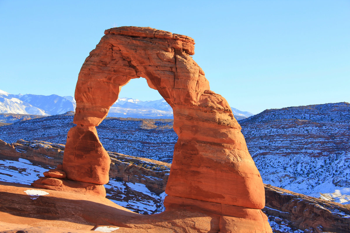
1. Delicate Arch
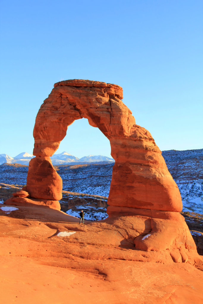
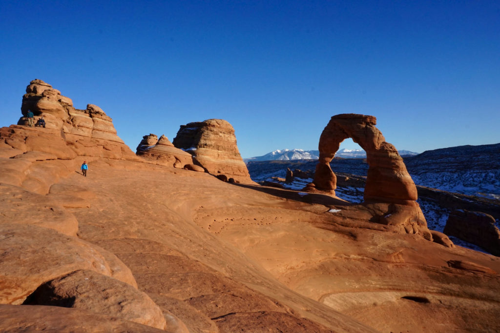
Without a doubt, Delicate Arch is the number 1 natural stone arch to see in Arches National Park and in the world. Anyone who’s seen the Utah state license plate has “seen” Delicate Arch. Not only is the arch itself magnificent, but the surrounding sandstone bowl and view of the mountains in the distance make the viewing experience of this arch all the more jaw-dropping.
Delicate Arch is one of the arches in the park that requires a decent hike to reach. However, if you’re not up for the hike, you can view the arch from a distance from either or both the Lower Delicate Arch Viewpoint and Upper Delicate Arch Viewpoint. The parking lot for the Delicate Arch Viewpoints is located beyond the Wolfe Ranch parking lot, 14.2 miles from the park entrance.
But, if you’re physically fit enough to make the ascent, you should prioritize hiking to Delicate Arch as your #1 thing to do in Arches.
It’s important to note that many rescues take place on this trail for people who underestimate the difficulty. Before hiking, carefully consider:
- Weather conditions (particularly summer heat and winter ice)
- Personal health and fitness
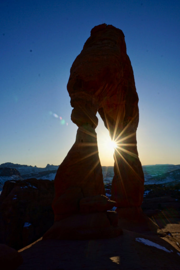
Note: Sunrise and sunset (most popular) are often very popular times to hike to Delicate Arch, especially in the high season when you may be accompanied by several hundred people. Plan accordingly as the parking lot fills up on busy days and may stay full for the majority of the day.
While Delicate Arch is stunning at both sunrise and sunset, keep in mind that half of your hike will be done largely in the dark. Be sure to pack a headlamp; and ice grips, if attempting this hike in the winter months.
My dad and I hiked to Delicate Arch for sunset on a weekday in January, and while we didn’t have to contend with any crowds, we did have to contend with ice on portions of the trail that were steep and narrow.
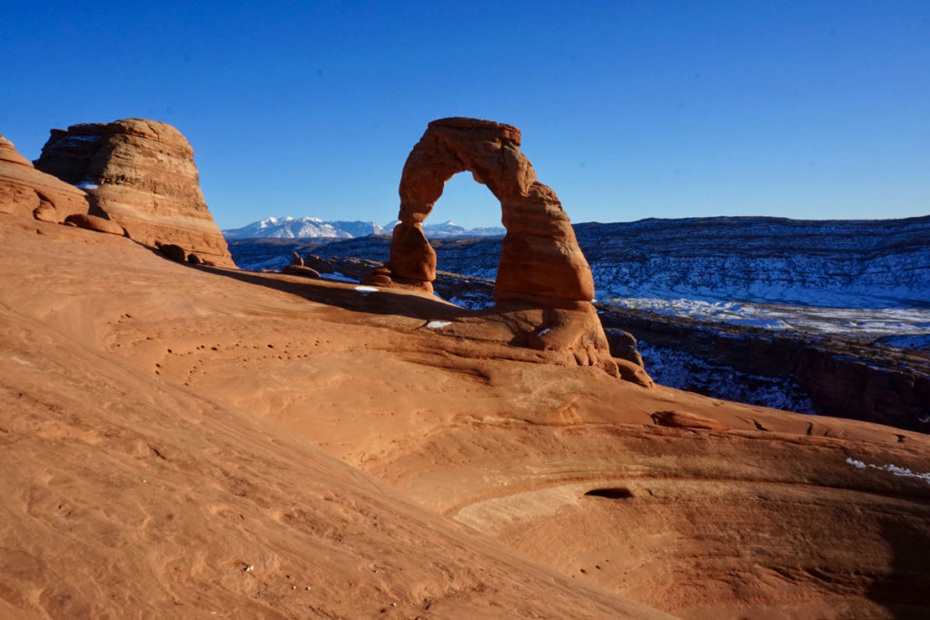
Trail Overview
- Claim To Fame: The largest free-standing arch in the park, and its pure beauty
- Section Of The Park: Wolfe Ranch
- Trailhead: Delicate Arch Trailhead
- Roundtrip: 3 miles (4.8 km)
- Elevation Gain: 480 feet (146 m)
- Difficulty: Moderate
- Route Type: Out-and-back
- Time To Hike: 1.5 hours on average
- Handicap Accessibility: Not handicap accessible
- Pet Policy: Pets are not allowed on this trail
- Facilities: Pit toilet at the trailhead; parking lot with 157 total spaces including 4 handicap spots and 28 oversized spaces, including limited oversized vehicle parking located across the street
- Points Of Interest: Wolfe Ranch Cabin, Ute Indian Petroglyphs, Delicate Arch
- Warning: Not recommended for those who are afraid of heights
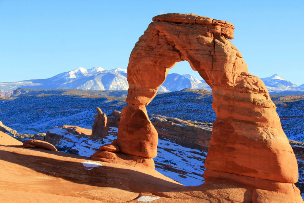
Note: If the Wolfe Ranch parking lot is full, check the Delicate Arch Viewpoint parking lot. However, starting from the Delicate Arch Viewpoint parking lot will add 1 mile to your hike in each direction. Therefore, the total hike distance will be 5 miles. The parking lot at the Delicate Arch Viewpoint is significantly smaller than that at Wolfe Ranch.
The Wolfe Ranch Parking lot is 13.2 miles from the park entrance (30-35 minutes).
2. Double O Arch
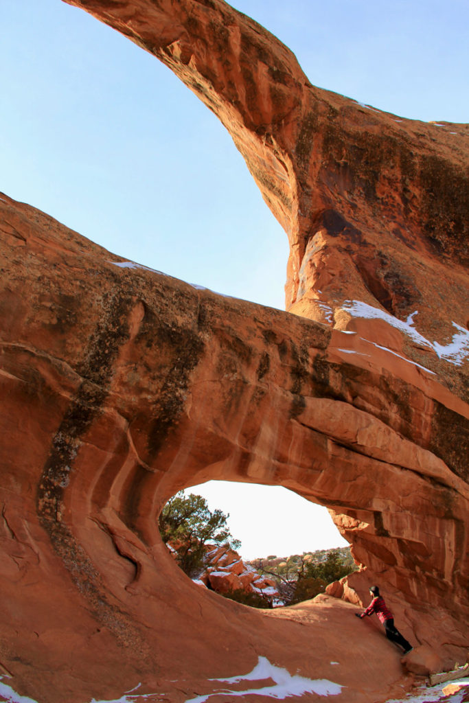
Double O Arch is an impressive double arch formed in the same fin of rock. The larger of the two O’s sits atop the smaller of the two. You can reach Double O Arch via a 4-mile hike in the Devils Garden section of the park.
The hike statistics below are solely for an out-and-back hike from the Devil’s Garden trailhead to the Double O Arch. However, this hike can be combined with any other portions of the Devils Garden trail. The total distance of all of the trails in the Devils Garden section including spurs is 7.9 miles (12.6 km).
Trail Overview
- Section Of The Park: Devils Garden
- Trailhead: Devils Garden Trailhead
- Roundtrip Distance: 4 miles (2.9 km)
- Elevation Gain: 469 feet (143 m)
- Difficulty: Moderate to Strenuous
- Route Type: Out-and-back
- Time To Hike: 2-3 hours on average
- Handicap Accessibility: Handicap accessible to Landscape Arch only
- Pet Policy: Pets are not allowed on this trail
- Facilities: Pit toilet at trailhead (year-round); drinking water (spring through fall), parking lot with 160 total spaces including 4 handicap spots and 10 oversized vehicle spots
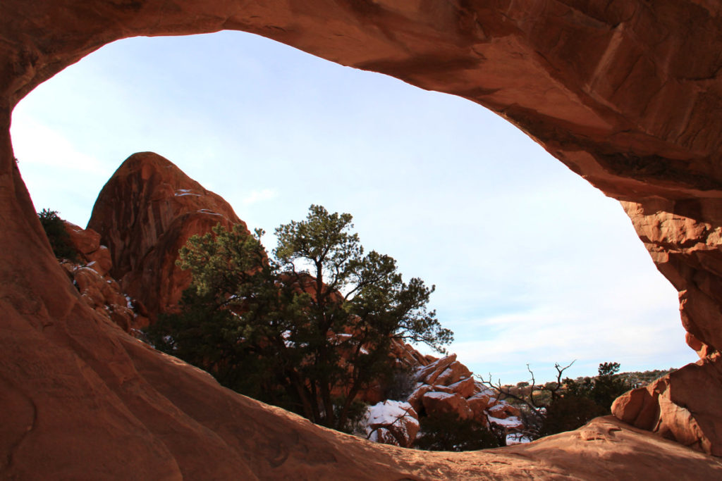
Hike Description: After reaching Landscape Arch, the trail becomes steep, continuing over sandstone slabs accompanied by narrow ledges with steep drop-offs and uneven surfaces. There are several spur trails to additional arches. If you continue 0.4 miles (0.6 km) beyond Double O Arch, you’ll reach Dark Angel.
The Devils Garden Parking Lot is located 18 miles from the park entrance (40-45 minutes).
3. Double Arch
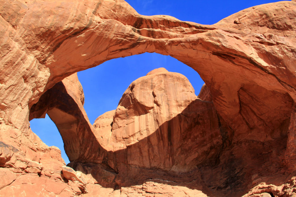
Double Arch, not to be confused with Double O Arch, is known as a pothole arch and was formed differently than most of the arches in the park. Rather than being formed by wind erosion from the side, Double Arch was formed by water erosion from the top of the arch.
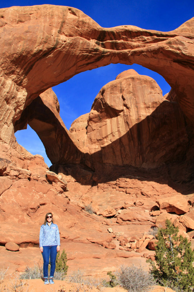
There’s no mistaking Double Arch’s prominence in the park, having the tallest opening of all the arches standing at 112 feet. It’s easy to see why Double Arch is one of the best arches in Arches National Park.
Trail Overview
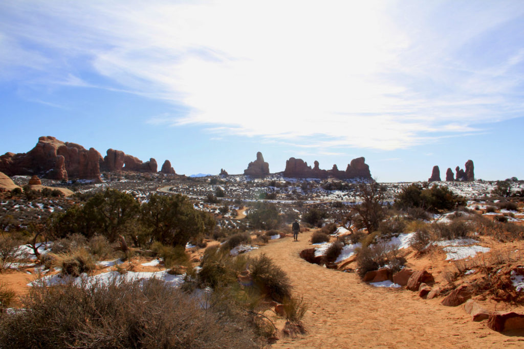
Located in the Windows Section, Double Arch can be reached by an easy out-and-back trail along a fairly flat, hard-packed gravel-surfaced path that can be accessed by a wheelchair with assistance.
- Claim To Fame: The tallest opening of all the arches in the park, standing at 112 feet
- Section of the Park: The Windows
- Trailhead: Double Arch Trailhead (leaves from The Windows lower parking lot)
- Roundtrip Distance: 0.6 miles (1 km)
- Elevation Gain: 30 feet (10 m)
- Difficulty: Easy
- Route Type: Out-and-back
- Time to hike: 15-30 minutes
- Handicap Accessibility: Handicap accessible with assistance (gravel-surfaced path)
- Pet Policy: Pets are not allowed on this trail
- Facilities: Pit toilet at the trailhead (year-round); upper and lower parking lots with 92 total spaces including 4 oversized spaces
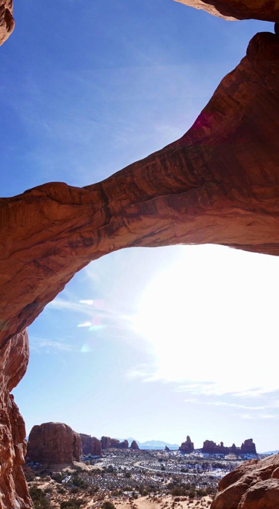
Fun fact: Double Arch was featured in the opening scene of Indiana Jones and the Last Crusade.
4. Partition Arch
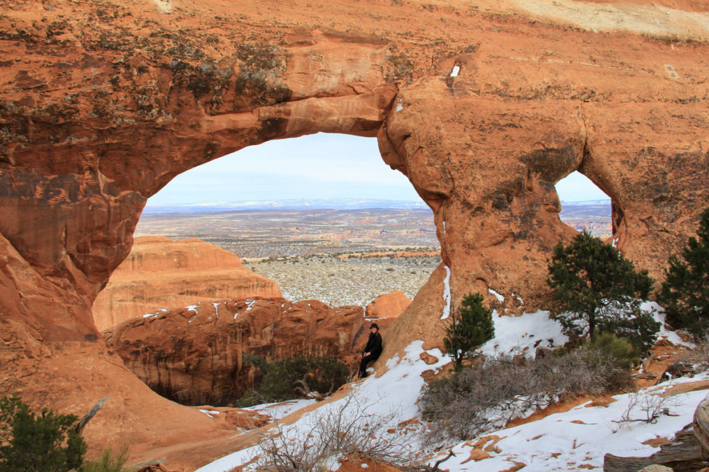
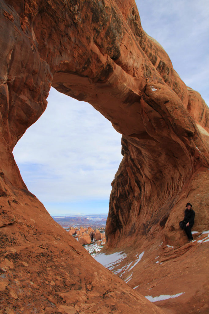
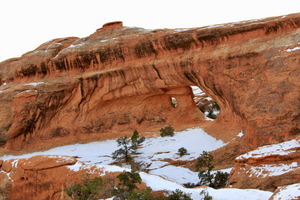
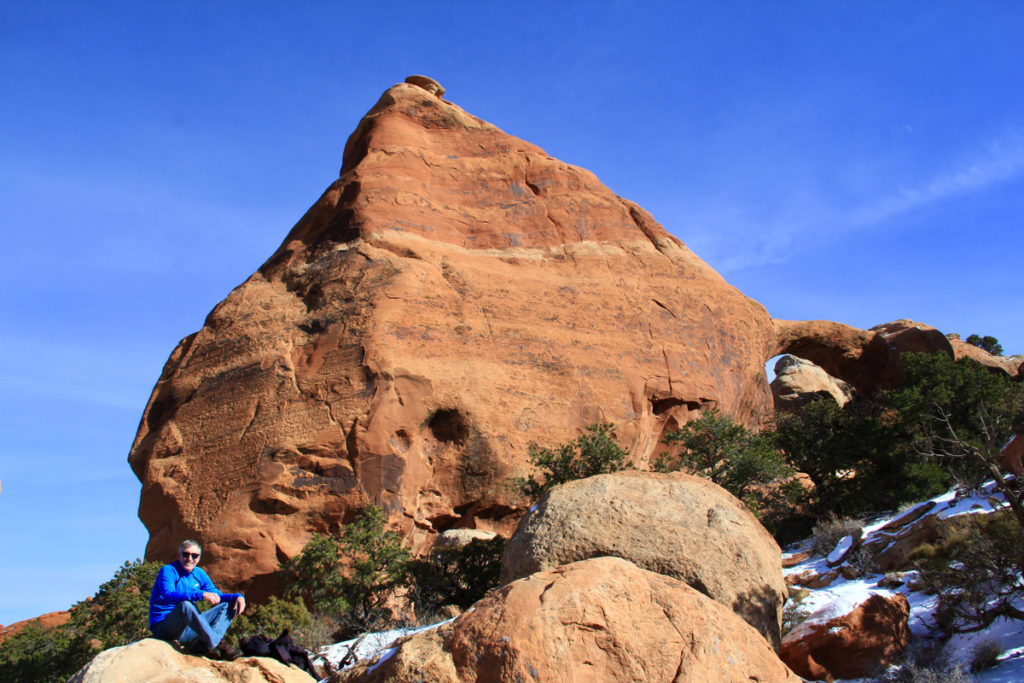
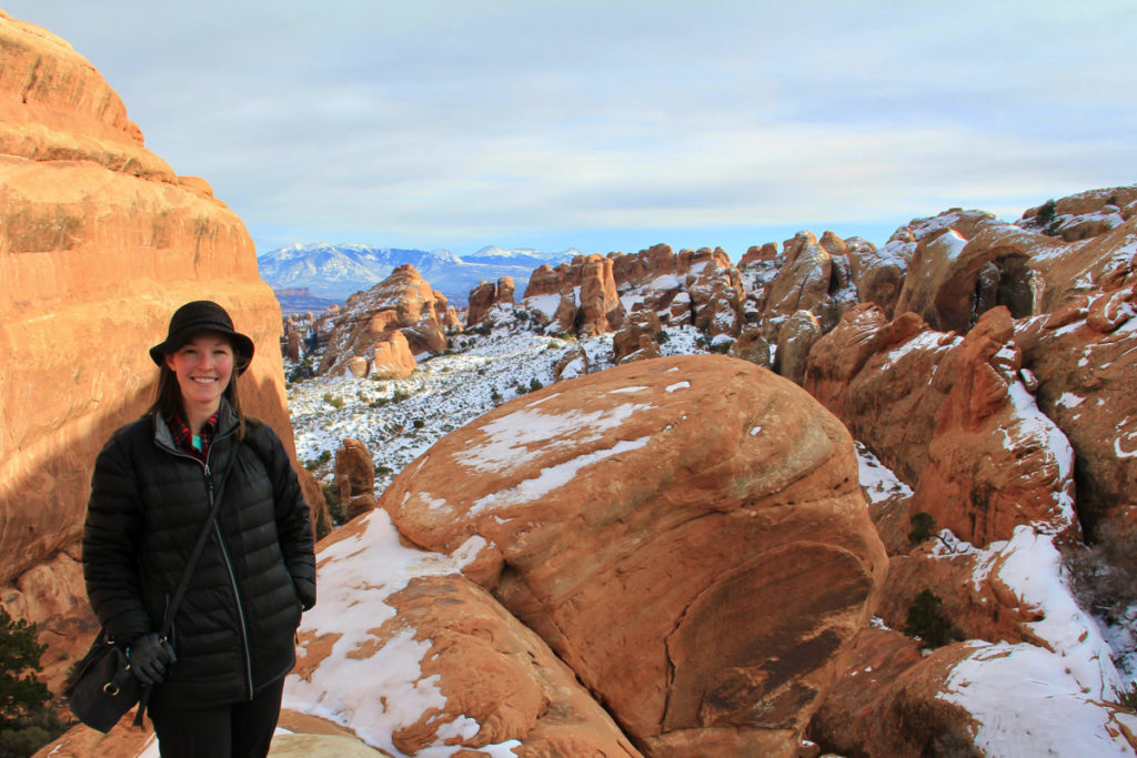
Partition Arch is a sandstone slab with two windows, one large and one much smaller. Partition Arch was one of my favorite arches in the park because of the beautiful view from the arch and the fact that my dad and I had it all to ourselves.
The hike statistics below are solely for an out-and-back spur hike from the Devils Garden Primitive Loop Trail to Partition Arch. However, this hike can be combined with any other portions of the Devils Garden trail. The total distance of all of the trails in the Devils Garden section including spurs is 7.9 miles (12.6 km).
Trail Overview
- Section Of The Park: Devils Garden
- Trailhead: Spur trail to Partition Arch and Navajo Arch from Devils Garden Primitive Loop Trail
- Roundtrip Distance: 0.4 miles (0.6 km)
- Elevation Gain: 89 feet (27 m)
- Difficulty: Easy
- Route Type: Out-and-back
- Time To Hike: 15 minutes on average
- Handicap Accessibility: No
- Pet Policy: Pets are not allowed on this trail
- Facilities: None; however there is a pit toilet at the Devils Garden trailhead (year-round); drinking water (spring through fall), and a parking lot with 160 total spaces including 4 handicapped spots and 10 oversized vehicle spots
Hike Description: This is a short spur trail slightly beyond Landscape Arch. After reaching Landscape Arch, the trail becomes steeper and more technical.
Be sure to add Partition Arch to your list of best arches in Arches National Park.
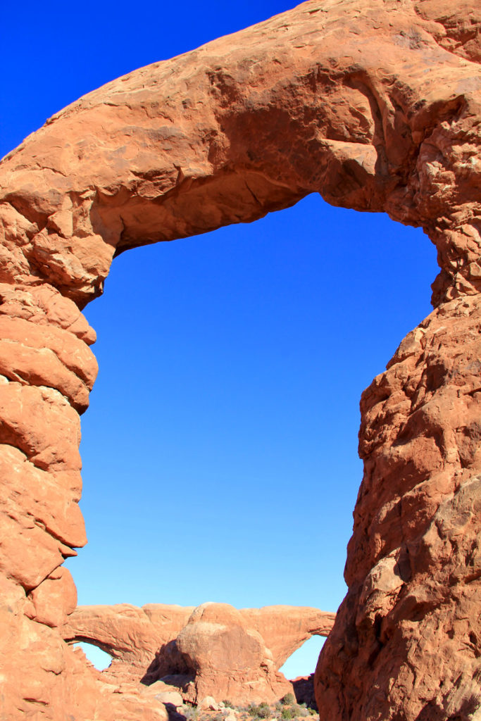
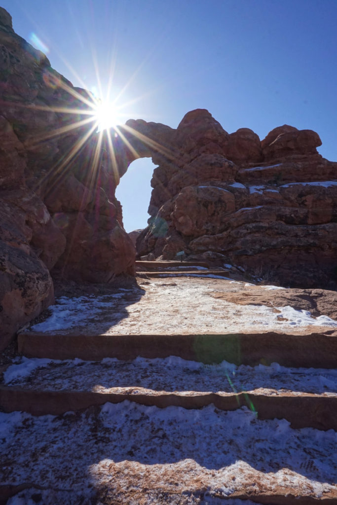
5. Turret Arch
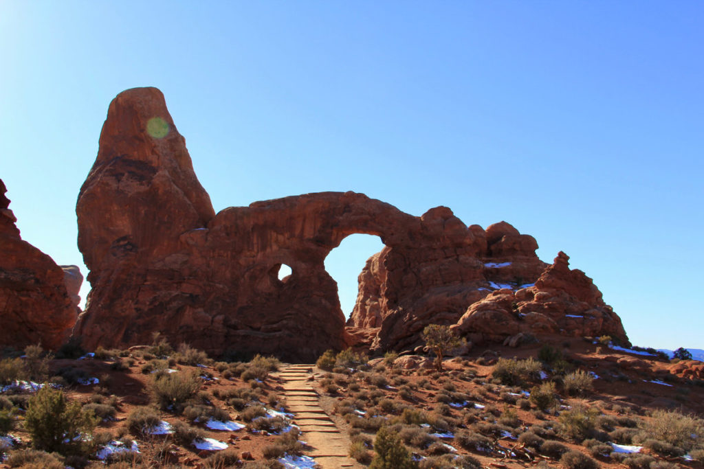
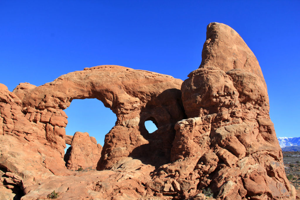
Turret Arch gets its name from its castle-like spire. It’s located in the Windows section near the North Window and South Window arches. It is best hiked as part of the Windows Loop Trail, although you could choose to just go on the Turret Arch spur trail from the parking lot and retrace your steps. The loop trail is 1.2 miles and the trail overview is detailed under the South Window section below.
Note: Turret Arch is best photographed in the morning.
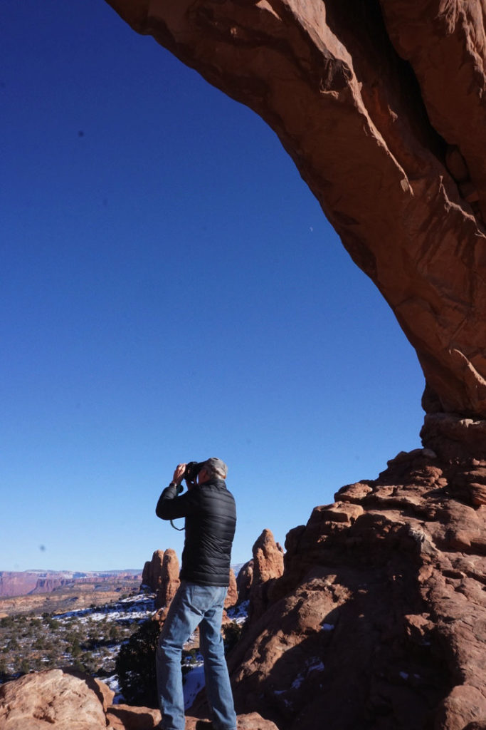
6. North Window
As mentioned above, the North Window arch is located in the Windows section along the Windows Loop Trail. Be sure to take some time to appreciate the view of Turret Arch through the North Window. This vantage point makes for incredible photographs.
7. South Window
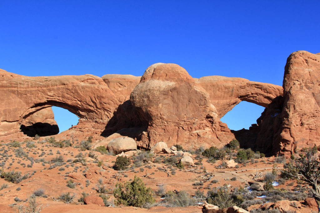
As mentioned above, the South Window arch is located in the Windows section along the Windows Loop Trail.
Trail Overview
The Windows Loop Trail includes Turret Arch, North Window, and South Window. The trail is flat and hard-packed for the first 100 yards (91 m). However, the remainder of the trail includes uneven surfaces, stone steps, and elevation gain.
- Section of the Park: The Windows
- Trailhead: The Windows Parking Lot
- Roundtrip Distance: 1.2 miles (1.9 km)
- Elevation Gain: 154 feet (46.9 m)
- Difficulty: Easy
- Route Type: Loop
- Time to hike: 30 minutes
- Handicap Accessibility: Handicap accessible for the first 100 yards
- Pet Policy: Pets are not allowed on this trail
- Facilities: Pit toilet at the trailhead (year-round); upper and lower parking lots with about 75 parking spaces between the two lots including handicap-accessible spaces
Note: This hike can be done as a 1-mile out-and-back if you want to avoid the primitive loop part of the trail which is very uneven with steps and has fewer trail markers, thus the National Park Services warns to pay close attention to the trail markers to stay on the trail.
The Windows Section is 12 miles from the park entrance.
8. Landscape Arch
Landscape Arch is not only impressive in its large span but also in the fact that portions of the arch fell in 1991 leaving the remainder of the arch to hang on by a thin thread.
The hike statistics below are solely for an out-and-back hike from the Devil’s Garden trailhead to the Landscape Arch viewpoint. However, this hike can be combined with any other portions of the Devils Garden trail. The total distance of all of the trails in the Devils Garden section including spurs is 7.9 miles (12.6 km).
Trail Overview
- Claim To Fame: The longest span of all the arches in the park reaching 306 feet in width
- Section Of The Park: Devils Garden
- Trailhead: Devils Garden Trailhead
- Roundtrip Distance: 1.9 miles (3.1 km)
- Elevation Gain: Relatively flat with no significant elevation gain, only moderate hills over hard-packed surfaces
- Difficulty: Easy
- Route Type: Out-and-back
- Time To Hike: 50 minutes on average
- Handicap Accessibility: Handicap accessible
- Pet Policy: Pets are not allowed on this trail
- Facilities: Pit toilet at the trailhead (year-round); drinking water (spring through fall), parking lot with 160 total spaces including 4 handicap spots and 10 oversized vehicle spots
9. Sand Dune Arch
Sand Dune Arch is accessible from a very small parking loop on the main park road shortly before you reach the Devils Garden parking lot. The trail begins hard-packed but quickly turns to thick sand and narrows into a cavern before reaching Sand Dune Arch. You’ll walk over a portion of slick rock, so be sure to wear shoes with good traction. This hike can be combined with several other arches in the area, including Broken Arch and Tapestry Arch.
Trail Overview
- Trailhead: Sand Dune Arch Trailhead
- Roundtrip Distance: 0.4 miles roundtrip (0.6 km)
- Elevation Gain: 0 ft
- Difficulty: Easy
- Route Type: Out-and-back
- Time To Hike: 15-30 minutes on average
- Handicap Accessibility: Not handicap accessible
- Pet Policy: Pets are not allowed on this trail
- Facilities: Parking lot with 2 handicap spots, 19 car spots, 4 RV spots
10. Broken Arch
Although the name would imply otherwise, Broken Arch isn’t actually broken. It gets its name from a crack that runs through the center of the arch. Broken Arch is located near Sand Dune Arch and can either be accessed from the connector trail leading from Sand Dune Arch or from the Broken Arch Trailhead which leaves from the Devils Garden Campground.
The statistics below are for the hike that leads out and back to Broken Arch from the Broken Arch Trailhead.
Trail Overview
- Trailhead: Broken Arch Trailhead on Campground Rd in the Devils Garden Campground
- Roundtrip Distance: 1.7 miles (2.7 km) (2.3 miles (3.7 km) for the Broken Arch Loop Trail)
- Elevation Gain: 167 feet (51 m)
- Difficulty: Easy
- Route Type: Out-and-back, but can also be hiked as a loop
- Time To Hike: 40 minutes on average
- Handicap Accessibility: Not handicap accessible
- Pet Policy: Pets are not allowed on this trail
- Facilities: Restrooms; no parking lot at the Broken Arch Trailhead (closest parking lot outside of the campground is the Devils Garden parking lot about 0.7 to 1 mile away)
11. Skyline Arch
Skyline Arch is aptly named for its row of evenly shaped and sized rectangular boulders that look like skyscrapers in a skyline. This arch lost one of its boulders in 1940, creating a much larger opening. Remnants of the rockfall can be seen along the trail. There’s a small pull-off from the main park road, however, it doesn’t have any marked parking spaces.
Trail Overview
- Trailhead: Skyline Arch Trailhead
- Roundtrip Distance: 0.4 miles (0.6 km)
- Elevation Gain: 28 feet (8 m)
- Difficulty: Easy
- Route Type: Out-and-back
- Time To Hike: 10-20 minutes on average
- Handicap Accessibility: Not handicap accessible from the trailhead; however, the arch is handicap accessible from a paved path leading from the Devils Garden Campground amphitheater on the opposite side of the arch
- Pet Policy: Pets are not allowed on this trail
- Facilities: Parking spots for less than 10 cars in the pull-out at the trailhead
12. Tunnel Arch
The Tunnel Arch viewpoint is the first spur trail for an arch that you’ll encounter from the Devils Garden Trailhead.
The hike statistics below are solely for an out-and-back hike from the Devils Garden trailhead to the Tunnel Arch viewpoint and back. However, this hike can be combined with any other portions of the Devils Garden trail. The total distance of all of the trails in the Devils Garden section including spurs is 7.9 miles (12.6 km).
Trail Overview
- Section Of The Park: Devils Garden
- Trailhead: Devils Garden Trailhead
- Roundtrip Distance: 0.7 miles roundtrip (1.13 km)
- Elevation Gain: 154 feet (47 m)
- Difficulty: Easy, one steep hill
- Route Type: Out-and-back
- Time To Hike: 22 minutes on average
- Handicap Accessibility: Handicap accessible until the spur trail diverges to Tunnel Arch
- Pet Policy: Pets are not allowed on this trail
- Facilities: Pit toilet at trailhead (year-round); drinking water (spring through fall), parking lot with 160 total spaces including 4 handicap spots and 10 oversized vehicle spots
13. Pine Tree Arch
The Pine Tree Arch trail is another spur trail off of the Devils Garden Trail that’s located opposite the Tunnel Arch spur trail. It gets its name from the pine tree that you can see framed by the arch. Including the Pine Tree Arch trail in your hike will add an additional 0.3 miles total, 42 feet of elevation gain, and 8 more minutes on average. All other hiking statistics are the same as mentioned above for Tunnel Arch.
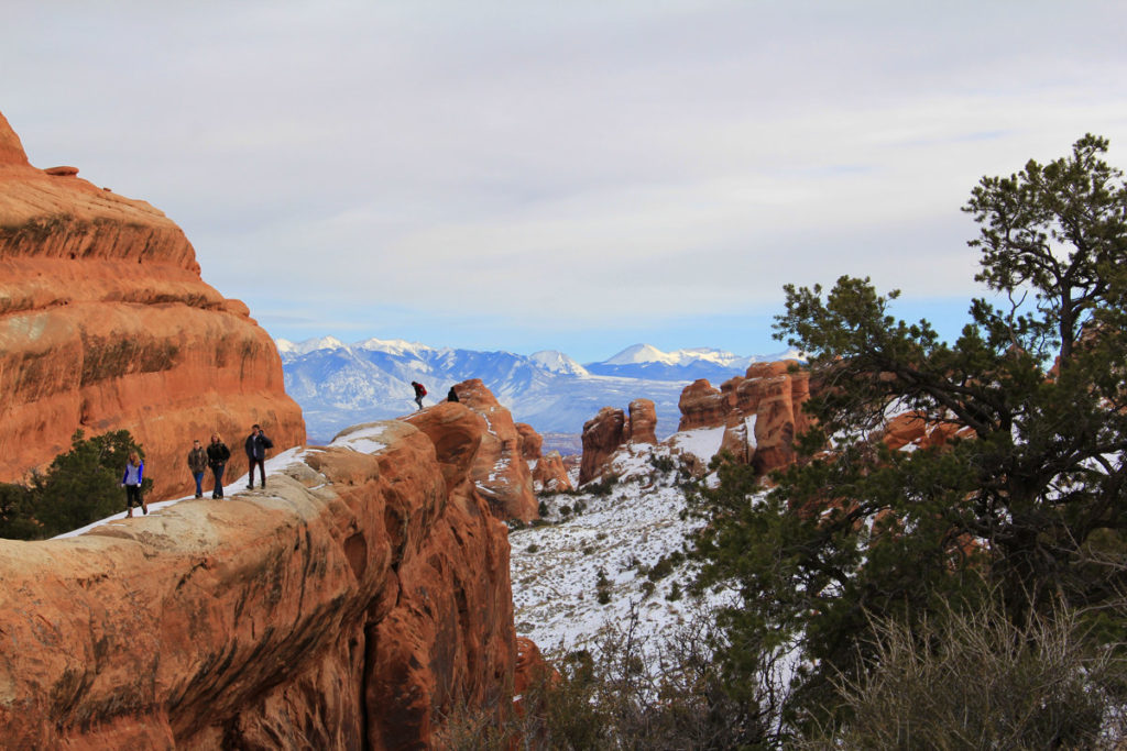
14. Navajo Arch
Navajo Arch is an arch along a spur of the Devils Garden Trail that’s just beyond Partition Arch, shortly after Landscape Arch.
The hike statistics below are solely for an out-and-back hike from the Devil’s Garden Primitive Loop Trail to Navajo Arch. However, this hike can be combined with any other portions of the Devils Garden trail. The total distance of all of the trails in the Devils Garden section including spurs is 7.9 miles (12.6 km).
Trail Overview
- Section Of The Park: Devils Garden
- Trailhead: Spur trail to Navajo Arch and Partition Arch from Devils Garden Primitive Loop Trail
- Roundtrip Distance: 0.6 miles (1 km) for spur trail (2.9 miles roundtrip (4.7 km) from Devils Garden Trailhead)
- Elevation Gain: 82 feet (25 m)
- Difficulty: Easy
- Route Type: Out-and-back
- Time To Hike: 15 minutes on average
- Handicap Accessibility: No
- Pet Policy: Pets are not allowed on this trail
- Facilities: None; however there is a pit toilet at the Devils Garden trailhead (year-round); drinking water (spring through fall), and a parking lot with 160 total spaces including 4 handicapped spots and 10 oversized vehicle spots
Tip: Hike to Navajo Arch after visiting Partition Arch. Hiking to both of these arches will add 0.8 miles (1.3 km) to your total hike distance.
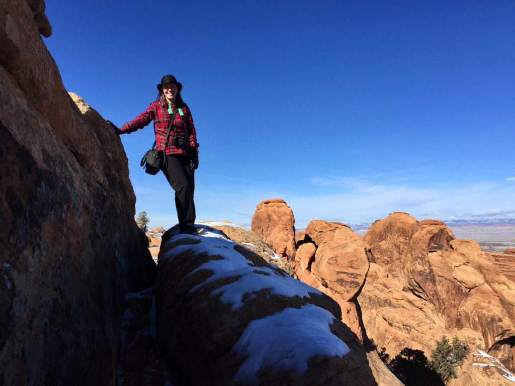
15. Private Arch
Private Arch is part of the eastern section of the Devils Garden Primitive Trail, which diverges to the right from the main trail just before the Landscape Arch viewpoints.
The hike statistics below are solely for an out-and-back hike from the trailhead to Private Arch. However, this hike can be combined with any other portions of the Devils Garden trail. The total distance of all of the trails in the Devils Garden section including spurs is 7.9 miles (12.6 km).
Trail Overview
- Section Of The Park: Devils Garden
- Trailhead: Devils Garden Trailhead
- Roundtrip Distance: 0.5 miles (0.8 km) for spur trail (5.3 miles roundtrip (8.5 km) from Devils Garden Trailhead)
- Elevation Gain: 69 feet (21 m)
- Difficulty: Easy
- Route Type: Out-and-back
- Time To Hike: 20 minutes
- Handicap Accessibility: No
- Pet Policy: Pets are not allowed on this trail
- Facilities: None; however there is a pit toilet at the Devils Garden trailhead (year-round); drinking water (spring through fall), and a parking lot with 160 total spaces including 4 handicapped spots and 10 oversized vehicle spots
16. Tapestry Arch
Tapestry Arch is an arch flanked by two false arch alcoves which some say resemble intertwined threads of a tapestry.
The hike statistics below are solely for an out-and-back hike from the Broken Arch trailhead to Tapestry Arch. However, this hike can be combined with Broken Arch and/or Sand Dune Arch as part of a longer circuit.
Trail Overview
- Trailhead: Broken Arch Trailhead on Campground Rd in the Devils Garden Campground
- Roundtrip Distance: 0.6 miles (1 km)
- Elevation Gain: 42 feet (12.8 m)
- Difficulty: Easy
- Route Type: Out-and-back
- Time To Hike: 13 minutes on average
- Handicap Accessibility: Not handicap accessible
- Pet Policy: Pets are not allowed on this trail
- Facilities: Restrooms; no parking lot at the Broken Arch Trailhead (closest parking lot outside of the campground is the Devils Garden parking lot about 0.7 to 1 mile away)
8 Rock Formations And Other Arches
17. Park Avenue + Park Avenue Arch
Park Avenue is the first stop for many visitors to Arches National Park. The jutting spires along the sandstone wall at Park Avenue resemble skyscrapers lining a city street. The Park Avenue Arch is located to the right far up a rock wall and is visible from the parking lot.
The trail to the Park Avenue viewpoint is flat, paved, and handicap accessible. After the viewpoint, the trail becomes inaccessible to wheelchairs as it continues another 1 mile to the Courthouse Towers, descending steps deep into the canyon.
18. Courthouse Towers
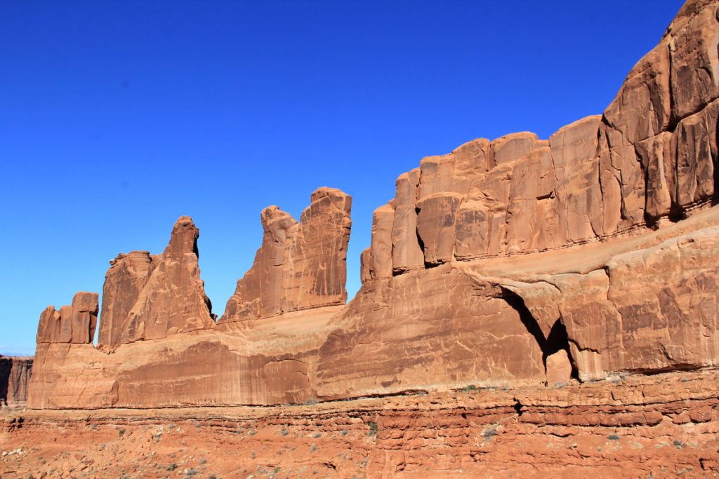
The Courthouse Towers are visible from the main park road shortly after passing the Park Avenue turnout and are accessible along the northern end of the Park Avenue Trail.
The hike statistics below are for both the Park Avenue Viewpoint and the Courthouse Towers.
Trail Overview
- Trailhead: Park Avenue Trailhead southern end of the trail OR northern end of the trail across from the Courthouse Towers parking lot
- Roundtrip Distance: 1.8 miles (3.2 km)
- Elevation Gain: 298 feet (90.8 m)
- Difficulty: Easy to Moderate
- Route Type: Out-and-back
- Time To Hike: 50 minutes on average
- Handicap Accessibility: Handicap accessible for the first 320 feet of paved path until the Park Avenue Viewpoint when departing from the southern Park Avenue Trailhead; not handicap accessible from the northern end of the trail across from the Courthouse Towers parking lot.
- Pet Policy: Pets are not allowed on this trail
- Facilities: Limited parking at both trailheads
Hike Description: When departing from the Park Avenue Trailhead at the southern end of the trail, you’ll encounter a steep descent into the canyon down a long flight of stairs after the Park Avenue Viewpoint. The trail becomes uneven with slippery rocks and sand.
For those who wish to avoid the stairs, either turn around at the Park Avenue Viewpoint or start from the northern end of the trail across from the Courthouse Towers parking lot and turn around at the base of the stairs. Wear footwear with good traction.
Note: If hiking the trail roundtrip, return back on the trail rather than walking around on the main park road.
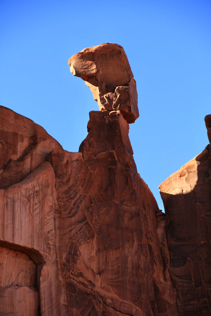
19. Three Gossips + A Tiny Arch
The Three Gossips, also known as The Three Kings, and a tiny arch can be seen from the main park road. However, for those who want to enjoy the rock formations for longer, view them from the Courthouse Towers Viewpoint or the northern end of the Park Avenue Trail. You’ll quickly notice the Three Gossips and a tiny arch ahead and to your right soon after starting your hike from the northern end of the trail.
20. Balanced Rock
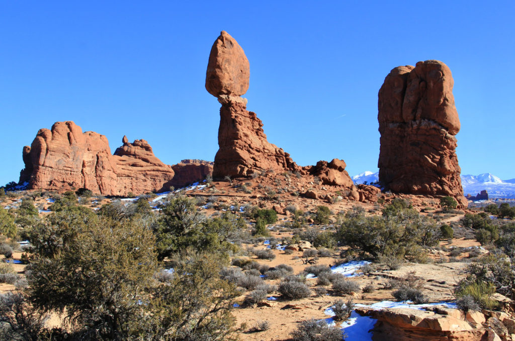
Balanced Rock is what appears to be an impressive balancing act on display. However, it’s actually not a balancing act at all! The gravity-defying boulder is in fact attached to its eroding pedestal below.
Balanced Rock can be seen from the park road (9.2 miles from the park entrance), enjoyed from the viewpoint, or fully embraced by taking the short hike around it.
For a viewpoint of The Windows and La Sal Mountains, continue walking the Balanced Rock loop trail beyond Balanced Rock.
Trail Overview
- Trailhead: Balanced Rock Trailhead
- Roundtrip Distance: 0.3 miles (0.4 km)
- Elevation Gain: 35 feet (11 m)
- Difficulty: Easy
- Route Type: Loop
- Time To Hike: 15-30 minutes
- Handicap Accessibility: The trail is flat and paved until Balanced Rock. After Balanced Rock, the trail becomes uneven with rocky surfaces, slopes, and steps.
- Pet Policy: Pets are not allowed on this trail
- Facilities: Small parking lot with 1 handicap-accessible spot, 12 car spots, and 4 RV spots. There’s a picnic area and pit toilet to the west of Balanced Rock down a gravel road (Willow Springs Trail/BLM 378).
Tip: Visit Balanced Rock at sunset to see it glow orange.
21. Sheep Rock + Baby Arch
Sheep Rock is located in the Courthouse Towers area of Arches National Park and can be viewed from the Courthouse Towers parking lot and viewpoint or the northern end of the Park Avenue trail. Look for Baby Arch in the rock wall to the left of Sheep Rock.
22. The Organ
The Organ is a rock formation resembling a pipe organ that’s visible from the park road in the Courthouse Towers section.
Tip: Best viewed and photographed just after sunrise.
23. The Tower Of Babel
The Tower of Babel is a rock formation located just north of the Courthouse Towers parking lot along the main park road on the right-hand side of the road.
24. Dark Angel Spire
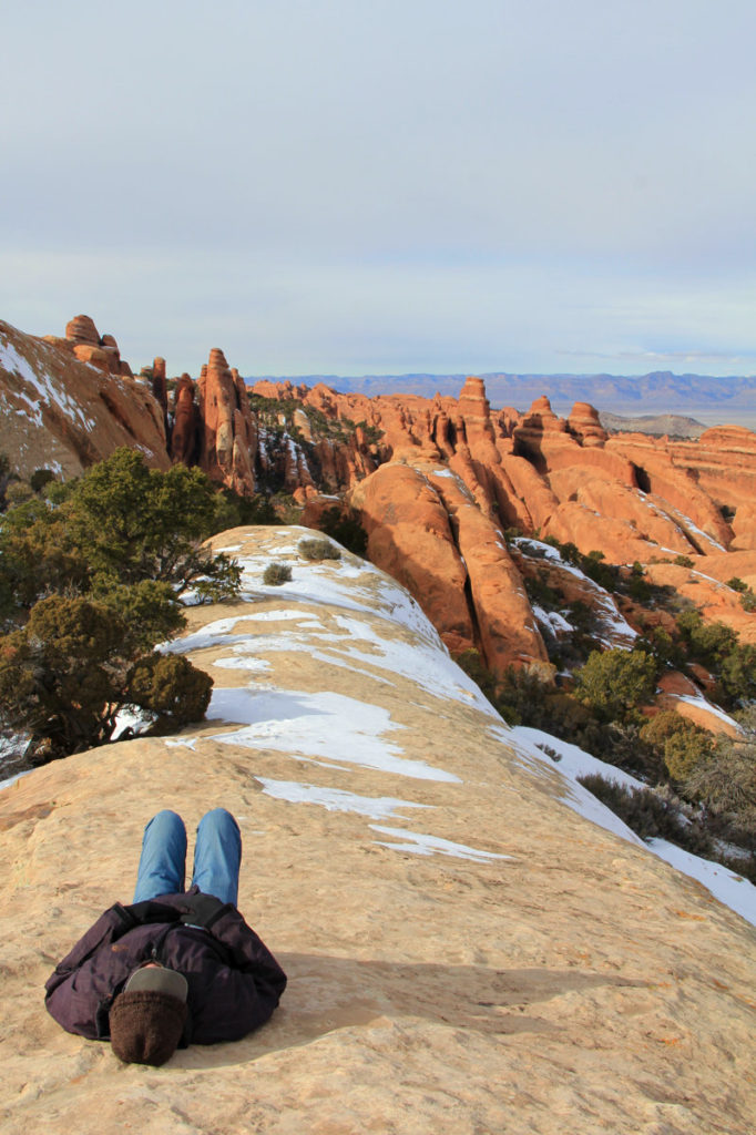
Dark Angel is a 150-foot-tall dark sandstone spire. 10,000-year-old Petroglyphs from the Ancestral Pueblo and Fremont culture can be seen at the base of the spire. Dark Angel is located half a mile northwest of Double O Arch.
The hike statistics below are solely for an out-and-back hike from the Dark Angel spur trail that diverges from the Devils Garden Primitive Loop Trail to Dark Angel and back. However, this hike can be combined with any other portions of the Devils Garden trail. The total distance of all of the trails in the Devils Garden section including spurs is 7.9 miles (12.6 km).
Trail Overview
- Section Of The Park: Devils Garden
- Trailhead: Dark Angel spur trail from Devils Garden Primitive Loop Trail
- Roundtrip Distance: 0.8 miles (1.3 km) for spur trail (4.7 miles roundtrip (7.6 km) from Devils Garden Trailhead)
- Elevation Gain: 65 feet (19.8 m)
- Difficulty: Easy
- Route Type: Out-and-back
- Time To Hike: 20 minutes on average
- Handicap Accessibility: Not handicap accessible
- Pet Policy: Pets are not allowed on this trail
- Facilities: None; however there is a pit toilet at the Devils Garden trailhead (year-round); drinking water (spring through fall), and a parking lot with 160 total spaces including 4 handicapped spots and 10 oversized vehicle spots
Arches National Park Information
What Is Arches National Park?
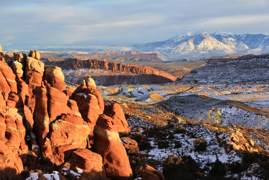
Arches National Park is a wildly popular national park in Utah. It welcomes a growing 1.5 million visitors to marvel at its picturesque red sandstone arches and rock formations. Many of the formations can be easily viewed from one’s vehicle or by short walks, making the park all the more approachable.
Where Is Arches National Park?
Arches National Park is located in the southwest United States. The closest town to Arches is Moab, Utah, located 5.5 miles and approximately 11 minutes away from the park entrance.
How To Get To Arches National Park
The closest airport to Arches is about 4 hours away in Salt Lake City, Utah.
To reach Arches from Moab, drive approximately 4.5 miles north of Moab on US-191 N. Turn right onto Arches Entrance Road. Continue driving straight for 0.6 miles until you reach the park entrance station. You’ll be greeted by the Visitor’s Center on your right after entering the park.
Book your rental car for your trip to Arches below through RentalCars.com!
Entrance Fee & Timed Entry Reservations
To enter Arches National Park without a pass, the cost is $30 per vehicle, $25 per motorcycle, and $15 per person if entering on foot. Read more about accepted passes under the “tips” section below.
Timed entry reservations are currently required for visits from April 1st through October 31st, however, check this page for the latest information before your visit. Timed entry tickets can be reserved for $2 on reservations.gov.
Parking In Arches National Park
Parking inside the park is extremely limited at all locations. Parking at popular trailheads such as Devils Garden and Delicate Arch often fill for hours at a time, particularly on holidays and weekends. Full parking lots may require park staff to close the park entrance until congestion subsides, which can last for 3 to 5 hours.
Oversized vehicle parking is also extremely limited. It’s highly recommended that you leave oversized vehicles at your accommodation or in the visitor center parking lot, however, that’s also limited with only 10 oversized spots.
Best Time To Visit Arches National Park
Arches National Park gets extremely crowded from March through October. If you visit during this time, expect long waits at the park entrance and a frustrating experience in general when driving throughout the park, as parking is very limited at most of the points of interest. You also may not be able to fully experience some of the best arches in Arches National Park due to a lack of parking and/or restricted access to the park.
If the line at the entrance station is backed up to the park entrance sign, your wait to enter the park may be up to an hour.
Instead, follow these recommendations for when to visit for reduced crowds:
- Visit outside of high season (November through February). The highest visitation occurs in May, June, and September, however, March through October remains very busy. In particular, avoid visiting the weeks surrounding Easter, Memorial Day weekend, and Labor Day weekend.
- Visit on a weekday.
- Enter the park before 8 AM or after 3 PM, especially if visiting during high season. Many parking lots at trailheads fill up by 7:30 AM during the summer.
Other Important Arches National Park Information
The park is open 24 hours per day, 365 days per year. Restrooms, drinking water, and outdoor exhibits remain open year-round.
Tip: Cellular service is spotty in the park and coverage varies by carriers. Therefore, download park maps and I would also highly recommend downloading offline Google Maps for the surrounding area before your trip as a backup.
Cellular signals are generally strongest when the La Sal Mountains are visible. Areas with reliable cell signal for most carriers are:
- Arches Visitor Center
- Panorama Point
- Balanced Rock
- Delicate Arch (at the end of the trail only)
- Fiery Furnace Viewpoint
- Salt Valley Overlook
Sandstone walls disrupt cell service in the following areas:
- Park Avenue / Courthouse Wash
- The Windows
- Fiery Furnace
- Delicate Arch Viewpoint
- Devils Garden
8 Tips For Optimizing Your Visit To Arches
- Don’t forget to reserve your timed entry into the park, if required at the time of your visit!
- Download offline maps and take a trail map with you. The Devils Garden trail in particular is poorly signed and service is poor or non-existent, so even if you have download maps on All Trails, they likely won’t work.
- Plan ahead and make a prioritized list of the top things you want to see in the park and visit them in an order that limits backtracking so that you don’t miss out on some of the best arches in Arches National Park.
- Pack your Park pass if you have one – you can enter with a 7-day Arches pass; an annual for Arches, Canyonlands, Hovenweep, and Natural Bridges; or an America The Beautiful National Parks and Federal Recreation Lands Interagency Pass.
- Plan to spend at least one full day inside Arches National Park with an extra day or two of buffer in the area, in case park access is restricted due to crowds.
- Use the restroom before getting in the car line to enter the national park, as the entrance process can take a long time.
- Enter the park with a full tank of gas as there is not a gas station inside the park and you might be sitting idle for an hour or longer.
- Pack extra snacks and water to have on hand.
Book your Moab tours below through Get Your Guide.
Where To Stay On Your Visit To Arches National Park
Camping Inside Arches National Park
The only campground inside Arches National Park is the Devils Garden Campground and it has 51 sites, 2 of which are group sites. Campsites can be reserved from March 1st through October 31st. Campsites can be reserved up to 6 months in advance.
Between November 1st and the end of February, campsites are first-come, first-served.
Backpacking is allowed in Arches, however, there is only a small number of designated sites and you will be required to do off-trail travel and route finding.
Camping Outside of Arches National Park
Kayenta Campground in nearby Dead Horse State Park is another option that’s about 40 minutes away from the entrance to Arches (and 21 minutes from the Island in the Sky Visitor Center at Canyonlands National Park). Kayenta Campground is small in size with only 21 campsites.
However, there are at least 29 nearby campgrounds located on Bureau of Land Management (BLM) property all approximately one hour or less away from Arches National Park, with 13 of these campgrounds approximately 15 minutes or less away from the entrance to the park and another 8 less than 30 minutes away from the entrance.
The BLM campgrounds closest to the entrance to Arches National Park in order from closest to farthest are Jaycee Park Campground (8 minutes), Goose Island Campground (10 minutes), Williams Bottom Campground (10 minutes), Grandstaff Campground (13 minutes), Moonflower Campground (14 minutes), Kings Bottom Campground (14 minutes), Gold Bar Group Campground (14 minutes), and Courthouse Rock Campground (15minutes).
Additionally, there are 17 commercial campgrounds in the area that offer more options.
Non-camping Accommodation Options
If you’re not planning to camp at one of the campgrounds, I’d recommend you stay in a hotel in nearby Moab, Utah which is about 11 minutes from the entrance to Arches National Park.
Book your Moab accommodation through Agoda below for the best deals!
In Summary: Is Visiting Arches National Park Worth It?
A visit to Arches National Park is 1,000% worth it! As I said at the beginning, Arches is one of my favorite national parks in the US, and the hike to Delicate Arch at sunset was one of the most memorable experiences I had in the park.
With careful planning using this guide to avoid peak hours and times of year, you’re sure to have a remarkable visit.
Arches are fragile and ever-changing. Several arches have come crashing to the ground over recent years, with the most recent fallen arch occurring in 2008. It’s the unfortunate fate that stares each of the arches in the face, day in and day out.
When will the next arch fall? No one knows, but one thing’s for certain, they won’t last forever. So, don’t wait too long if you want to be sure to marvel at the beauty of the best arches in Arches National Park.

